Status: Sovereign autonomous republic within Uzbekistan
Capital:
Total Area: ~166,600 km² (making up roughly 37% of Uzbekistan's total territory)
Population: ~ 2.061.000 residents
Time zone: UTC +5
Primary Languages: Karakalpak and Uzbek
Karakalpakstan is a sovereign Republic within Uzbekistan, located on the Turan lowland. The Kyzyl Kum Desert is in the north-east side and the Karakum Desert on the southwest. Karakalpakstan territory also includes the southern half of the Aral Sea and the lower reaches of the Amu Darya River. The total population is more than 2.061.000 people, half of whom live in cities, and the rest in the countryside. Generally, it is about the Uzbeks - 33%, Karakalpaks - 32%, Kazakhs - 26%. The rest of the population is the other nationalities.
Karakalpakstan Administrative center is Nukus city. There are 25 townships and 12 cities. Most of the territory is occupied by deserts (3.67 million hectares, more than 80% of the territory). Admiring the sandy scenery, you can also visit the ruins of the historic and medieval monuments. Today, there are over 300 archaeological sites. The most interesting of them are Toprak-Kala settlement (III-II centuries. BC), Gyaur Kala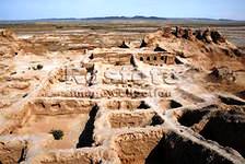 (IV-III centuries BC), Kyzyl-Kala (III-II centuries BC), Djanbas Kala fortress, Mazlumhan Sulu mausoleum, and many other interesting historical monuments. Inscriptions in the ancient Khoresm language were found during archaeological excavations in Koy Krylgan Kala town, fragments of which are stored in the Karakalpakstan Museum of Art. Muinak is also a very interesting place to visit.
In ancient times, the territory of Karakalpakstan was Khorezm. The architecture of that period was special to glazed paintings with ornamental and plant images. Surviving materials and fragments, arousing the great interest, can be seen in the State Museum of Art named after I.V. Savitsky. Having visited here, you will have the unique opportunity to get acquainted with the ancient history of all Khorezm oasis.